Our first circular walk in 2021 was a beautiful walk along Langden Brook, and back along Haredon Brook.


Nearby walk
Map
More media


Route description
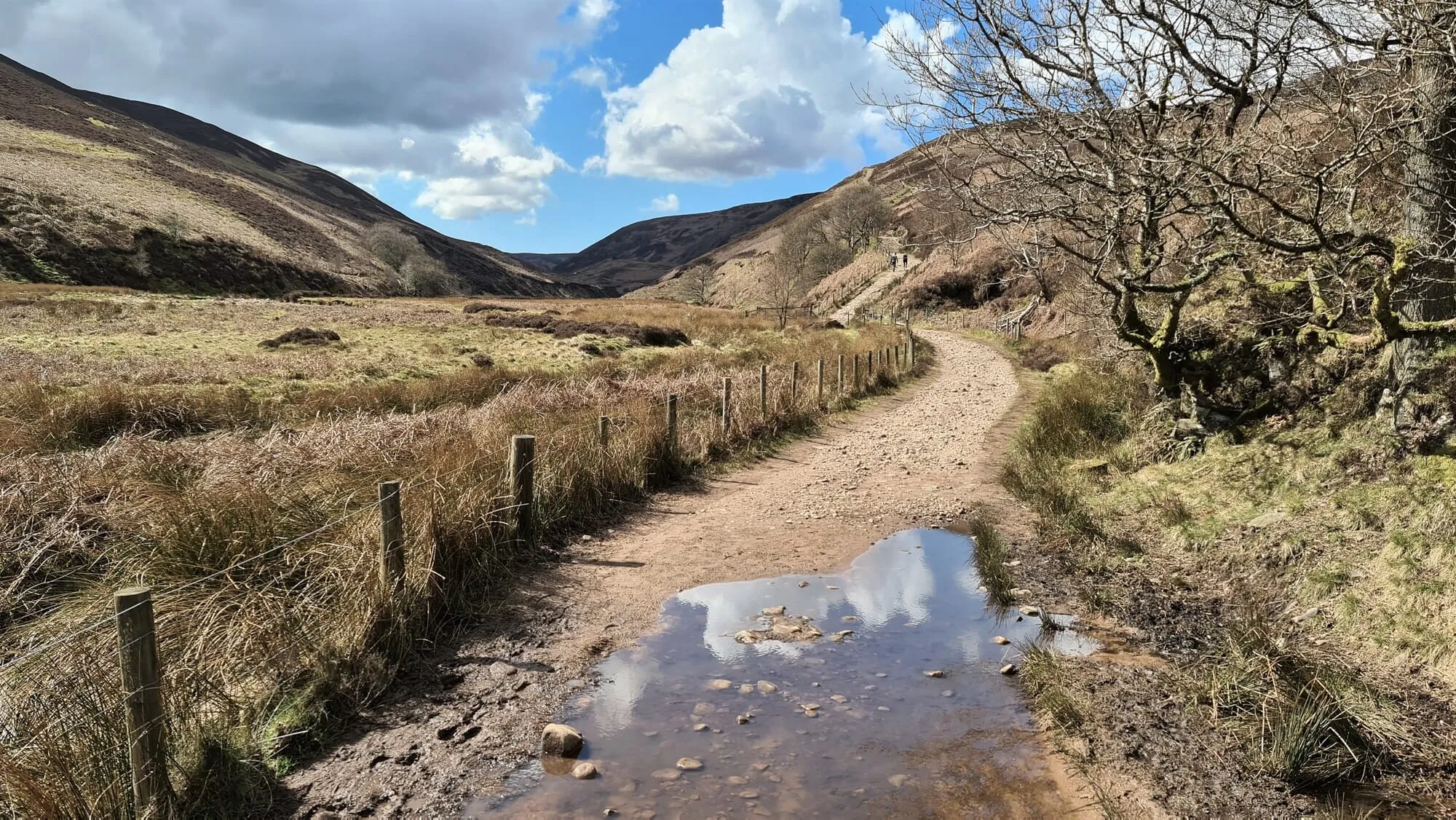
Today we embarked on one of our favourite walks in Bowland, along Langden Brook and back down along Haredon Brook. One of our party was only in trainers so we set off along Langden Valley knowing that we might have to turn back at Langden Castle if the water levels were high. Luckily this wasn’t a problem as the weather had been fairly dry and the brook levels were low.
The walk starts off along a tree-lined lane that leads to the water works and here there is a gate leading into the valley. After a short while the track splits in two and knowing that we may be doing a longer walk (and it being our first proper walk for a while) we took the lower of the two tracks.
Along with Beacon Fell, Langden Brook is perhaps the most popular spot in the Forest of Bowland. Indeed, there were lots of people out enjoying the sunshine with their families, but as we got closer to Langden Castle there were barely any people around (ideal for those who like to be away from the crowds).
Previously at the Langden Brook crossing I’ve lost boots, once almost lost one of my lads, and I’ve barely every made it across without getting my socks sodden. Today only one boot was breached, so it wasn’t too bad. We also figured out how to get our trainer-wearing companion across by throwing wellies back to her once we had crossed.
The next section of the walk follows a pleasant track above Bleadale Water. The clouds had drawn in and it started to snow, but rather this than rain! After a short while you can see the zig-zagging track cutting across Haredon Fell, and soon afterwards we were ascending the trail. The views at the top today were tremendous and well worth the effort.
My partner Jo is from the Lake District and is not a fan of moorland walks, the next section was therefore her least favourite section of the walk. Also worth noting is that I have done this walk about five times and have never taken the same route across, but luckily I have always managed to find the shooter’s track on Haredon Fell.
Now it is back onto drier land, where the track descends steeply towards ‘Scouts Rock’, where I’m sure I’ve heard peregrines before but never actually seen them. Hareden Brook Valley is similar in a way to Langden, but is more enclosed and offers a delightful descent back to Haredon Farm. After two hours of absolute remoteness, Haredon almost seems like a bustling community, but in reality it is just a small group of farms.
Next, it’s back to Trough Road, but just before you get to the road bear left to pass over the brook, which leads to a lovely track following Langden Brook again. Up the bank, across the water, you can see Bowland & Pennine Mountain Rescue HQ, Smelt Mell, and soon you arrive back at your starting point, Langden Brook car park.


