
Jeffrey Hill & Longridge Fell
")
")
")
")
")
Route info
| Postcode | PR3 2TT |
| Map Reference |
53.855533, -2.541997 |
| Low Point | 250 m |
| High Point | 344 m |
| Distance | 4.81 km – 3 miles |
| Difficulty | Very easy |
| Cows | None |
| Dogs | On leads |
| Nearby pub | Dog Inn |
| Nearby hotel | Gibbon Bridge |
Nearby walk
Other Links
Map
Post from RICOH THETA. – Spherical Image – RICOH THETA
Tim writes: Longridge Fell & Jeffrey Hill was home around 2013. I lived about a mile away as the the crow flies from the top. Naturally it is a fell I have explored many times, it’s one of my favourites.
Some might say it is a pretty featureless fell, having round edges and heather moors, but I have many fond memories of exploring nearly every inch.
Most people park at Jeffrey Hill when visiting, but a little further down the road is parking spot for about 5 cars, next to the fingerpost sign. This is where we parked today to start our walk.
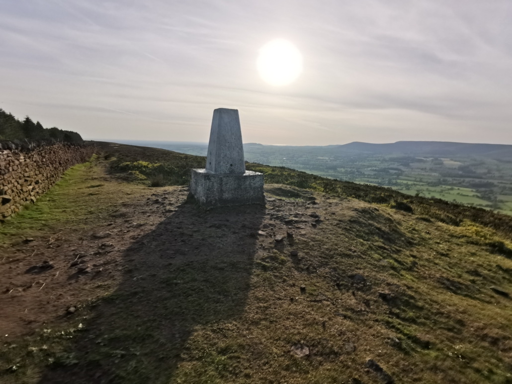
It is such an easy route to follow from here. Just follow the dry stone wall all the up to the trig point, which is marked as ‘Spire Hill’ on the Ordnance Survey map. Then climb the wall and head back down for a little while before walking through the plantations and meeting another path, and taking a right.
After a short time you meet your original track at the dry stone wall but continue in a northerly direction towards Jeffrey Hill. You could ignore this part of the walk and head back to the car to make the walk shorter. But this walk is very easy anyway, and can be completed in just over an hour at a good pace.
Thoroughly recommended, especially on an a warm summer’s evening!
